
Council Bluffs Drone Services
We Serve Council Bluffs
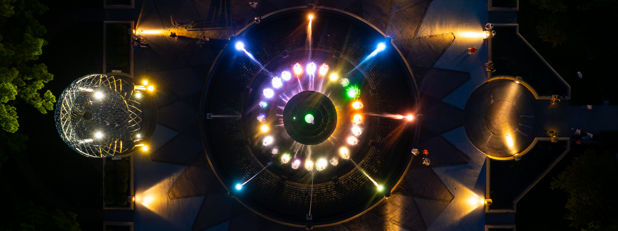
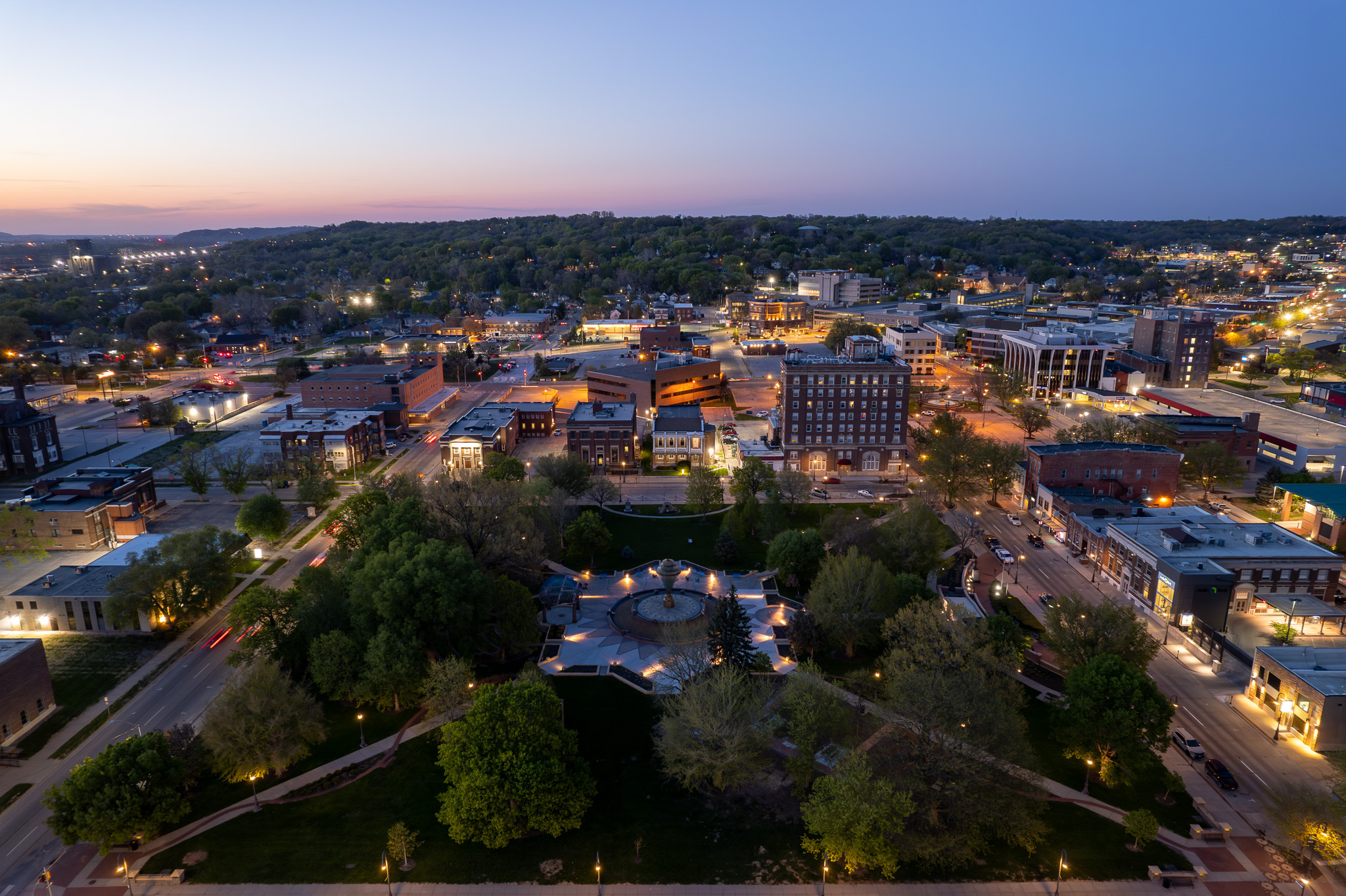
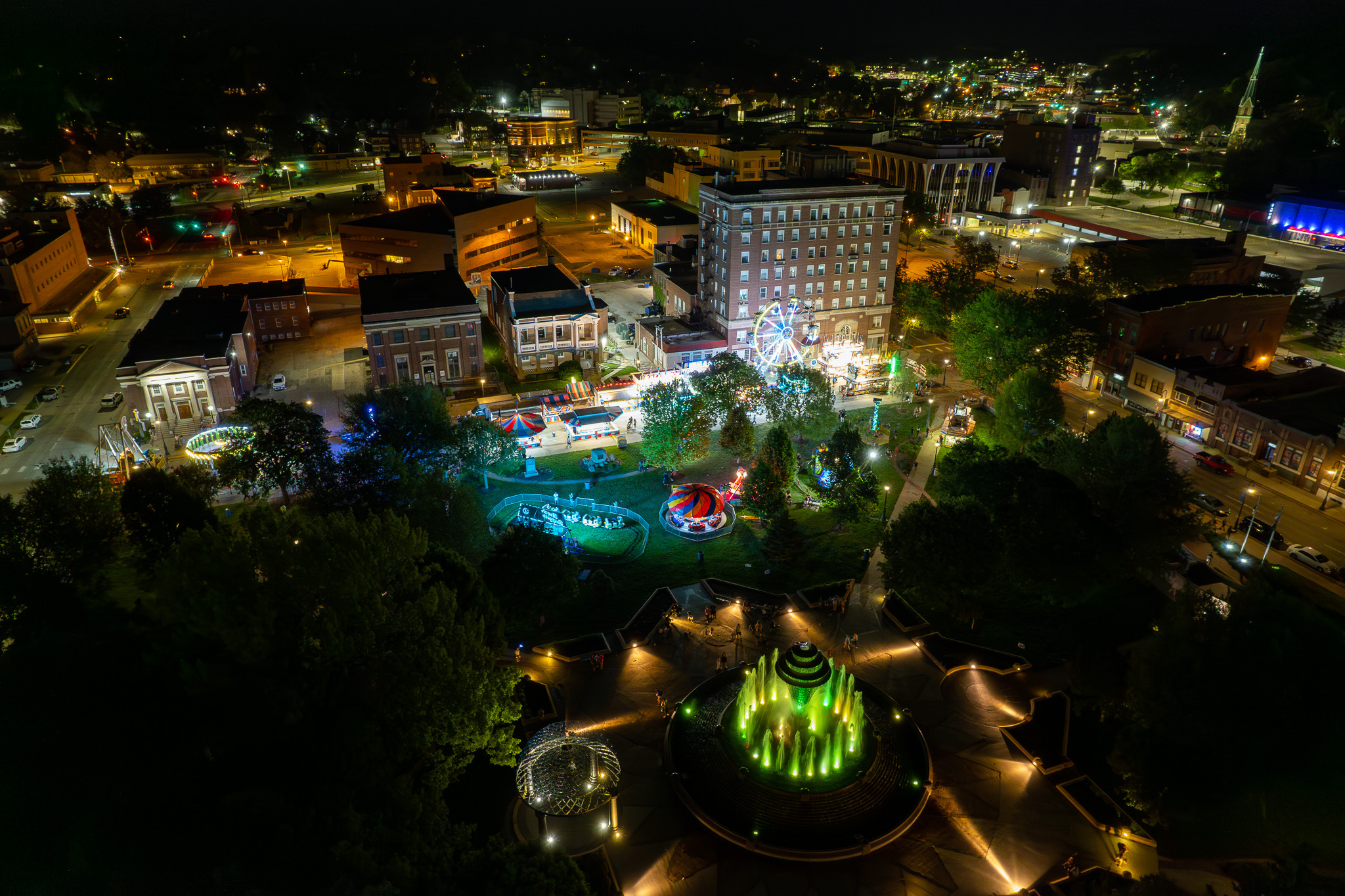
Skycam Imagery offers drone services to the Council Bluffs area. See Council Bluffs from a different perspective, the sky. Our drone photography and drone videography services can bring advertising materials for businesses, photos, and videos for events, and weddings to the next level. Our cost-efficient aerial photography packages scale for small, and large budgets. Every job is an experience we look forward to. Our inspiration and desire is to create the highest quality drone photos, and drone videos for you.
Council Bluffs Drone Photography
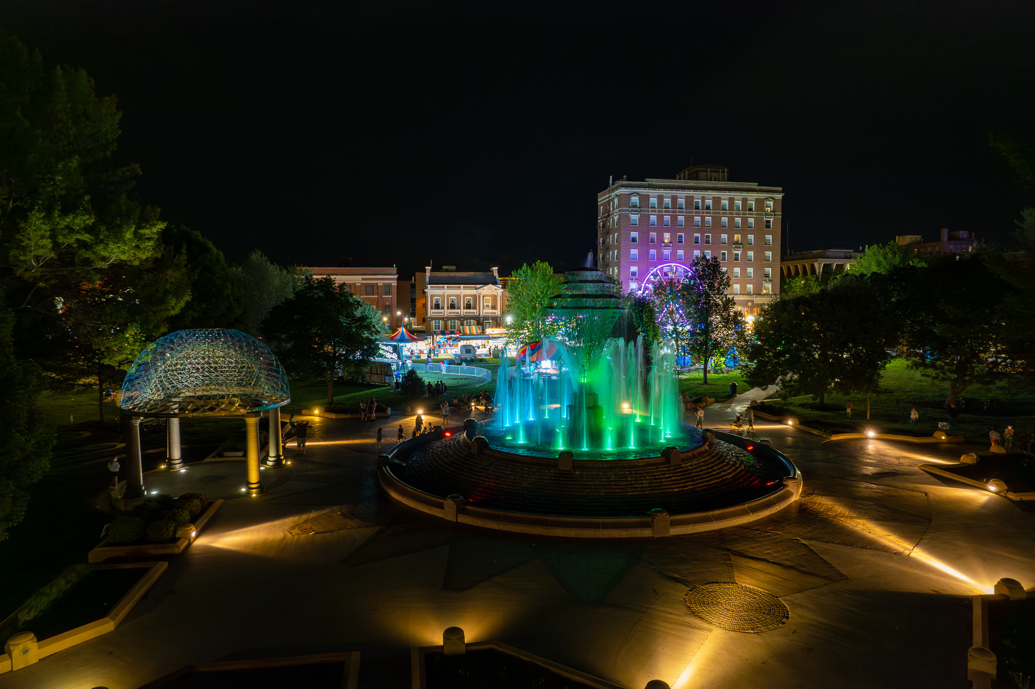
SkyCam Imagery provides stunning aerial photography at competitive prices. Our goal is to exceed your expectations and to create professional, and inspirational photos. Our Council Bluffs drone service offers real estate drone photography, construction drone photography, and drone photography for weddings, events, private parties, and social media. All of our photography packages include photo editing, color grading, and your company logo additions. Just the nature of being airborne elevates every image to a grander scale, coupled with the ability to frame the perfect shot, and the results are nothing short of amazing. Not only does SkyCam Imagery offer pre-packaged bundles, but we offer set pricing "a la carte" style with a sitting fee. With a la carte style pricing, you decide the duration of time, and when we are in the air. After the service is performed, you pick which pictures you want to purchase at a set price.
Post Processing
Post-processing is very important for a high-quality result. SkyCam Imagery includes post-processing in every package we offer. While we offer many different photo types, SkyCam Imagery shoots in DNG format. A DNG is a digital negative image that stores uncompressed image data in a more standardized format than raw, with a 20% smaller file size while maintaining the same high quality. Adobe launched the Digital Negative Specification in 2004 to encourage camera makers to standardize the file types used and shared by photographers. Dng gives greater control over the post-processing of a photograph, which results in much better photo results. While SkyCam Imagery can provide HDR photos, with DNG we can produce the same, and in our opinion, better results.
Council Bluffs Drone Videography
Not only does SkyCam Imagery provide aerial photography, but we also provide aerial videography. As with our drone photography packages, all of our construction drone videography, and real estate drone videography packages include video editing, and color grading, with an included option to add your company branding. We record in 1080, 2K, 4K, and 5K video, at 24, 30, and 60 frames a second. We use industry-leading software to ensure that the final product is spectacular. SkyCam Imagery flies with ND filters over the drone camera to make sure that the result is not blown out, and to create a more cinematic look.
How much does drone photography cost?
At SkyCam Imagery we offer many aerial photography solutions. We offer pre-bundled packages, a la carte style options, and hourly, and daily rates. If you would like to read more about drone photography pricing please see the links below.
Real Estate Drone Photography Pricing
Construction Drone Photography Pricing
Wedding Drone Photography Pricing
Event Drone Photography Pricing
A La Carte Pricing
Drone Mapping
Drone mapping is kind of like an aerial survey. Using photogrammetry, a drone can fly over a property, or building, and take photos that contain data which then can be stitched together into one large map of the entire property. Measurement data, elevation data, and plant health data are just some examples of data that can be taken from an orthomosaic map. Drone orthomosaic maps are to scale and highly accurate. Not only can data be exported, but a single large image of an entire property can be produced by a drone map. Drone mapping can also produce detailed 3D models of a structure which also retains measurement and volume data. Drone maps are great for construction, and event planning, and are often used to collaborate online with investors, and other colleagues. Usually, drone maps are to scale and very accurate as far as measurements within the map, but its location in the world can be off as much as 6 to 8 ft. This is where drones with an RTK unit or a PPK unit come into play.
• Inspection Videos
• Elevation Maps
• Digital Terrain Maps
• 2d Orthomosaic Maps
• 3d Orthomosaic Maps
Read more about SkyCam Imagery mapping services here.
FAA Certified & Insured
You should only hire an FAA Certified pilot. There are steep fines, and the possibilty of loss of licenses if you hire an unqualified person. SkyCam Imagery's drone photographer will be FAA Certified, and insured. By hiring SkyCam Imagery, you will receive a copy of credentials, and a certificate of insurance before job engagement.

Phone:
402-213-0760
E-mail:
107pilot@skycamimagery.com